Sponsored by

El Niño has returned for the first time since 2023–24 and could become one of the strongest “warm phase” events on record, rivaling those in 1982–83, 1997–98 and 2015–16. In fact, the Climate Prediction Center of the National Weather Service indicates there is a more than 80% chance that this El Niño will rank among the strongest events since reliable oceanic and atmospheric monitoring began in the mid-20th century.
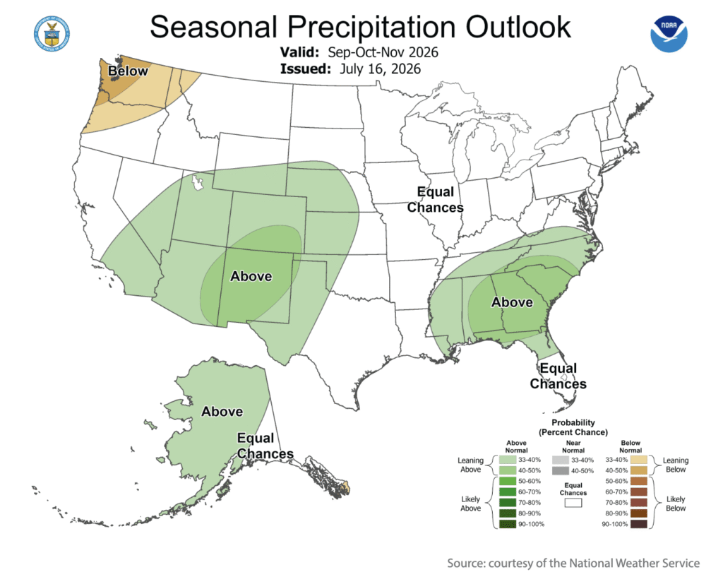
A strong El Niño does not guarantee weather extremes but could tilt the odds more in that direction. For the United States, El Niño-related weather effects tend to develop and become more pronounced during autumn. As El Niño intensifies, heavy rainfall events may become more frequent in parts of the South. Notably, the NWS September–November outlook indicates the likelihood of wetter-than-normal weather in much of the Southeast, as well as the Four Corners region and portions of neighboring states.
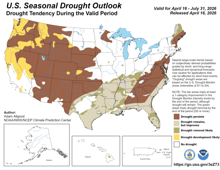
Meanwhile, odds are tilted toward autumn warmth and dryness in the Pacific Northwest. Historically, El Niño has often led to reduced U.S. drought coverage. For eight weeks in April and May 2026, drought coverage across the Lower 48 states topped 60%. By the end of June, that value had fallen below 48%.
Despite prospects for a warmer- and drier-than-normal 2026–27 cold season across parts of the North, wetness in other areas of the country may further reduce overall U.S. drought coverage and intensity. Still, the effects of drought — such as poor rangeland conditions and low reservoir levels — are deeply entrenched in many areas from the Pacific Coast to the Plains, and it may take more than a single autumn, winter and spring of stormy weather to fully eradicate the multiyear drought.